 |
|
 |
|
 |
 | MetaDraw |
 | MetaDraw Customer Application |
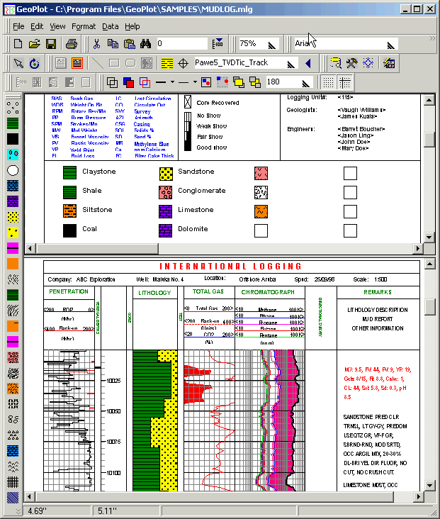
The GeoPlot Log Drafting Software is a feature rich Integrated Log Development Environment (ILDE) used for creating and editing an endless variety of well logs. GeoPlot utilizes the power and reliability of Windows NT/2000 to produce logs many times faster than previous log drafting packages while keeping the exported file sizes to a minimum to facilitate distributing exported log files over a shared network environment. Designing logs is accomplished by dragging and dropping graphical objects and text onto a preview screen that displays the log exactly as it will appear on the printer. GeoPlot automatically retrieves the latest data from the DLS online database while plotting the log to the screen. Below is a screenshot of the GeoPlot software displaying the toolbars, top design pane and bottom preview pane. 
Log Features: - Data
- Log data linked to DLS database
- Link objects to database records, files or even Internet URL`s
- Insert pictures or graphs in the header or log body
- Fill between any two curves
- Unlimited number of tracks
- Select database fields or calculated fields for track data
- Choose curve type, point to point or stair step
- Linear and logarithmic scales
- Versatile curve wrapping
- Custom line styles and fill patterns
- Data types include lines, histograms, symbols, lithology, static text, dynamic text and pictures
- Import and plot data from 3rd party sources such as Wireline or MWD services
- Plot data from multiple wells on a single log
- Create distinct log formats with common data associated with tracks. No need to duplicate data such as text or symbols that are common in two or more logs
- Format
- Versatile log design, virtually any type of log may be created
- Print preview while editing and viewing logs
- Automatically generate TVD logs
- Select any log scale and depth units
- Automatically adjusts data objects such as symbol position and text size so log prints perfectly at any scale
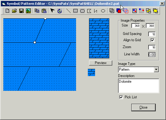
- Create an unlimited variety of custom lithology patterns and symbols including background colors
- Export
- GeoView Log Viewer software for viewing and printing logs
- Export to optimized proprietary log file format (mdr) or common graphics formats(wmf,emf,bmp)
- View and Print logs on Windows 95/98/NT/2000 computers
- Printing
- Print logs to all printers that support Windows 95/98/NT
- Print continuously to printers that support continuous printing
GeoPlot includes a versatile symbol and pattern editor (SymPat) shown below. 
Visually Create a dataset for the log from existing database tables. The dataset definition is saved with the log format and automatically configured when the log format is loaded. Check out our website: http://www.inter-log.com |

